Friday, September 14, 2012

Hiking Hassel Island in U.S. V.I.


Hassel Island was connected to St. Thomas by an isthmus until 1860. It was part of Charlotte Amalie town and formed part of the hurricane proof anchorage in the 1700s when the Danes controlled the islands and made the port a free trade port. It became a major port as they asked no questions of where goods came from so pirates sold their pillaged goods there freely. In 1860 a channel was dug through it from East Gregerie Channel to St. Thomas Harbor and the passage called Haulover Cut. It was dug to allow for better water flushing in the harbor and to shorten the passage between Crown Bay and St. Thomas Harbor.
Haulover Cut

In 1840 the world’s first steam driven ship railway was built on the North end of the island and is now in the process of being restored. It could haul out a ship 200’ long and weighing 800 tons.
The haul our building
Railway building under restoration


The original ruins at the top of the saddle are the homestead of the Hassel’s which includes a family grave yard.  The graves had been vandalized so the remains have been reburied on St. Thomas.  The family also ran a leper colony for St. Thomas, the only remaining ruin is the cistern.
Family graveyard
Carl examins tomb


Cistern is all that remains of the Leper colony
Cowell Battery observation post house
bathroom of observation point

The Danes built Prince Frederik’s Battery on the South end to protect the harbor. During the British occupation they renamed it Fort Willoughby and added Shipley Battery on the North end and Cowell Battery on the South end of the island with barracks in between.  When the US took over the island, Cowell Battery became an observation post to watch the water’s from Porto Rico to BVI. The ruins that are there are in very good shape as they were occupied into the 1970’s.
Fort Silloughby
Carl climbs observation pole

When the US bought the islands in 1917 they put a Navy station on the island and in 1919 widened and deepened Haulover Cut. In 1930 the Paiewonsky family bought Hassel and Water Islands to get water for their distilleries.  In 1978 they sold most of the island to the National Park Service keeping a few small buildings on the northeast side. One of them was where a reality show, Real Life, was filmed recently.  The only way to get to the island is by boat.
Old barracks ruins

Today there are several unmarked trails to many ruins on the island even though many of the ruins have very nice plaques describing the changes occurring on the island.  Many of the trails follow what must have been roads during all the occupying years.  The cleaning and marking of these trails would be a great eco-project for some ambitious volunteers.

Manfred in his loft
Some of Manfred's gardening

Today the only long term resident on the island is Manfred, who has life tenancy as he was living there before the National Park Service acquired the island. He is a sail maker who is well known in the Virgins and has set up shop in the ruins of an old steamship company at Careening Cove. He has an extensive collection of old tools and equipment he has found on the island in his many years there.
Manfred's patio


More of Manfred's landscaping


A lilme kiln on the beach
Carl examins the kiln


Sunday, September 9, 2012

St. Thomas Chili Off Contest


Every August for the past 28 years St. Thomas has a Chili cooking contest the proceeds of which go to local charities. It is sanctioned by the Society of Texas Chili Cookers. This contest is held on Brewer’s Bay Beach and draws contestants from all over the Virgins, Puerto Rico and the US mainland. This year the contest was held on Sunday August 19th and there were 74 entries which are judged by a panel of judges before the chili is offered to the public. We were anchored in Long Bay so at 8:30 we weighted anchor and motored over to Brewer’s Bay. As we dropped anchor we saw a tent city on the beach and could hear the PA announcing tickets were now on sale and beer was available at 10:00.
The Chili Off Tent City on Brewer's Bay Beach

We quickly took the dinghy in to get the scoop on this event. It turned out the contest didn’t start until noon, but most everyone was set up and the air was full of the aroma of cooking chili. The T shirts were too cool so we had to get a couple.
Love our T Shirts
Leslie is ready to PARTY!

Tickets for drinks were $1 each and a beer was 3 tickets, while the chili tasting tickets were $1 but you got 2 parts to the ticket and tastings turned out to be 1 ticket part per taste. We bought $20 of each! The contest was to go until 5PM when the winners would be announced and the music would end. There were several groups playing throughout the day. There is not much more to say other than we used all our tickets and had a great time meeting wonderful people. The Pictures say the rest.
Beth's Bar is ready for the end of the world as we know it
The sign says it all!


Want a free hourse? VI horse rescue and addoption
They make a good chili also
Coast Guard Search and RescureAlso make a hot meaty chili


 The Red Solo Cup group with the Red Solo Cup Olympics and their use of the cups to make all sorts of thinks was just too funny!


The Red Solo Cup extravaganza was great but the chili was salty
Leslie loves pirates
The Red Solo Cup Guys
Amazing what you can make with
 red solo cups


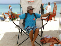
Carl relaxes at Hooters
Thier chili was great too!
What a great sand castle! It was fun to watch it develop

Sunday, September 2, 2012

Hiking Eastern St. John


St. John is a unique island in that 75% of it is National Park and almost all the water around it is part of the National Park or the Coral Reef National Monument. There are about 35 hiking trails on the island that is less than 9 miles long and less than 4 miles wide. The trails are a variety of lengths from 500 feet to 2.6 miles, which takes a little over 2 hours to hike. The park service provides maps of St. John and its trails, but a more detailed map, The Trail Bandit Guide, can be purchased from most stores.
Waterlemon Cay
Ruins overlooking Waterlemon Bay our boat in the arch

After saying good bye to the Vargas, we sailed on back to Francis Bay and grabbed a mooring. The next day we went around the point into Waterlemon Bay and took a mooring next to Waterlemon Cay. From there we dinghy into the beach and hiked the Leinster Bay Trail down the beach and up to some ruins. Then back along the bay to the locally famous Annaberg Ruins. This was a sugar cane plantation with horse and wind driven cane crushing devices to get cane juice which was then boiled down to sugar or molasses. This was then exported or fermented into rum and used locally or also exported. The ruins are in fairly good shape and maintained by the National Park Service.
Leslie in another ruins over Waterlemon

A short walk down the road brought us to the Annaberg School trail. This short trail brings you to the ruins of the Annaberg School. It’s the oldest school in the Caribbean and was established by the Danish plantation owners for their kids and the slave children. However, when slavery was abolished the children went to other schools and the building was deserted and abandoned. The building has a plaque that shows it was a 2 room, center hall school house with lower grades on one side and upper grades on the other.
Looking into Waterlemon Bay
Skinny Legs

The next day we hiked the Johnny Horn Trail over Base Hill to Coral Harbor. There we found the Bar, Restaurant, and tourist shop, Skinny Legs. It’s a fun place with good food and drinks as well as the meeting place for the Coral Bay Yacht Club. The Yacht Club is made up of locals who for the most part live on their boats in the bay. One of the ways they support the community is by running a few fund raiser events to provide additional funding for the local school. From Skinny Legs we had to walk down East End Road to Hermitage Ruins and Browns Bay Trail. The hike to Brown’s Bay took us by a shooting range and over Base hill again to Brown’s Bay. The beaches here were covered with Sargasso Weed so we didn’t take a swim break, but continued on back up to meet the Johnny Horn Trail and back to the boat.
Donkeys on the road to Brown Bay Trail

We sailed back to Maho Bay the following day and took the dinghy into Cinnamon Bay beach. This is a National Park beach with water sports equipment for rent, and an archeological dig, general store, bar and restaurant as well as tent sites and cottages for rent. Across the street we hiked the Cinnamon Bay Self-Guided Trail of another sugar factory ruins and a nature trail with signs labeling a lot of the trees and bushes as well as pictures of animals to be seen in the area. The hike was short and about half of it was made handicap accessible. Then it was a steep hike up the Cinnamon Trail to Center Line Road. To get back we had to hike down the road a mile to the Cathrineberg Road where we found the ruins of another sugar mill which brought us down from Peter Peak to the North Shore road on the coast and back to Cinnamon Bay.
self guided trail of sugar cane mill


Cinnamon Bay Beach


Part of the Mill
plantation house lived in until 1970


redition of plantation house


Cottage at Cinnamon Bay


On Cinnamon Beach we met Kendel who ran the water sports on the beach. He is a great guy and a big surfer. We found out that there is surf on St. John most of the year. We also met Torri and her son and his friend. We ran into them again at the Weston were they came for dinner bringing a Wahoo her son caught yesterday, and she was very interested in getting a boat after having dinner on ours.
 

Sugar Mill Ruins up on Cathrineberg Road

More of the Surgar Mill


Torri and Leslie on Frolic


The kids on Frolic's trampoline


After all that hiking we went snorkeling in the bay
 
Leslie Diving in Maho Bay Click arrow to see movie
A spotted Eagle Ray cruising By